Rick Roberts Way Masterplan London 2020–2021

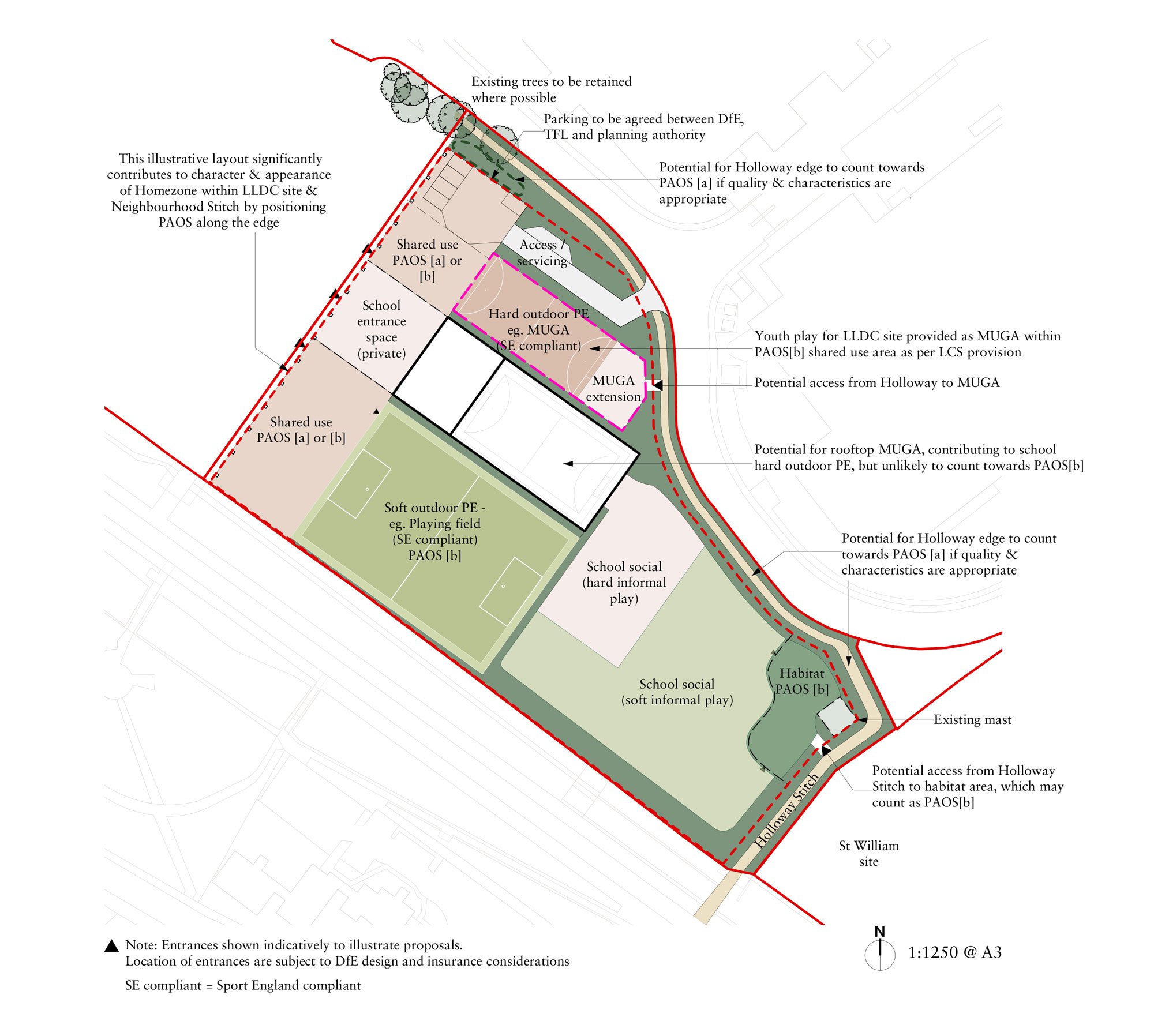
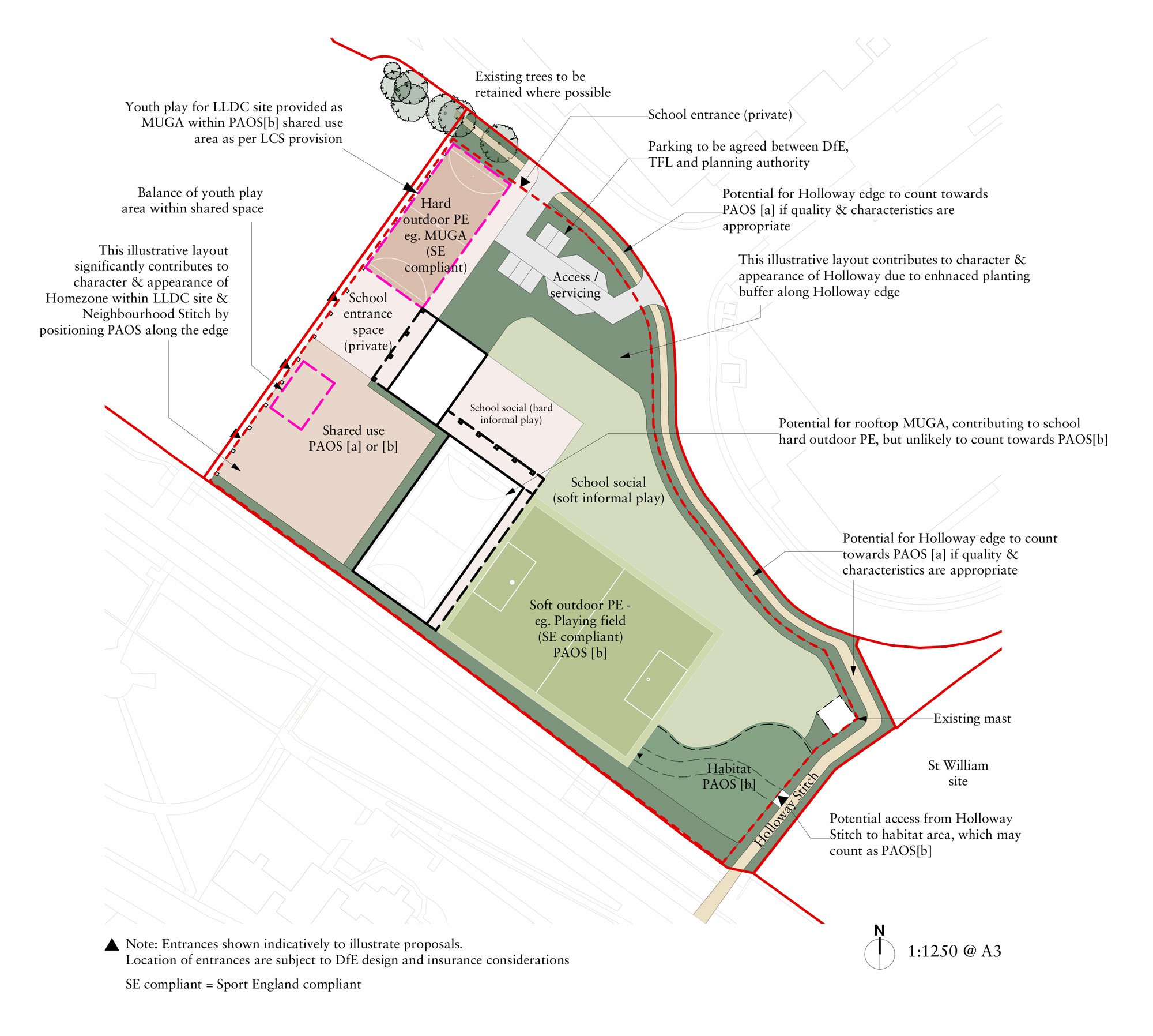
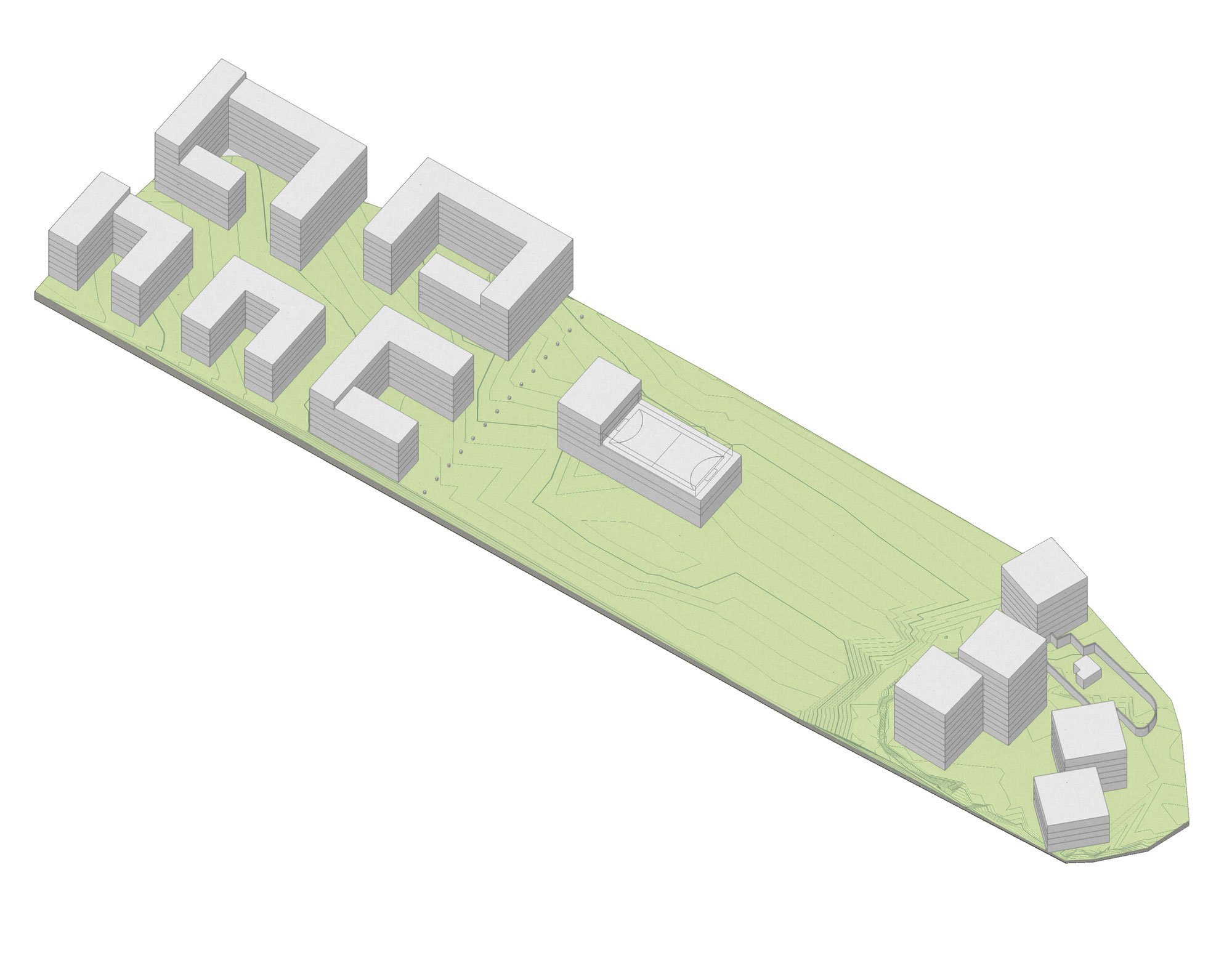
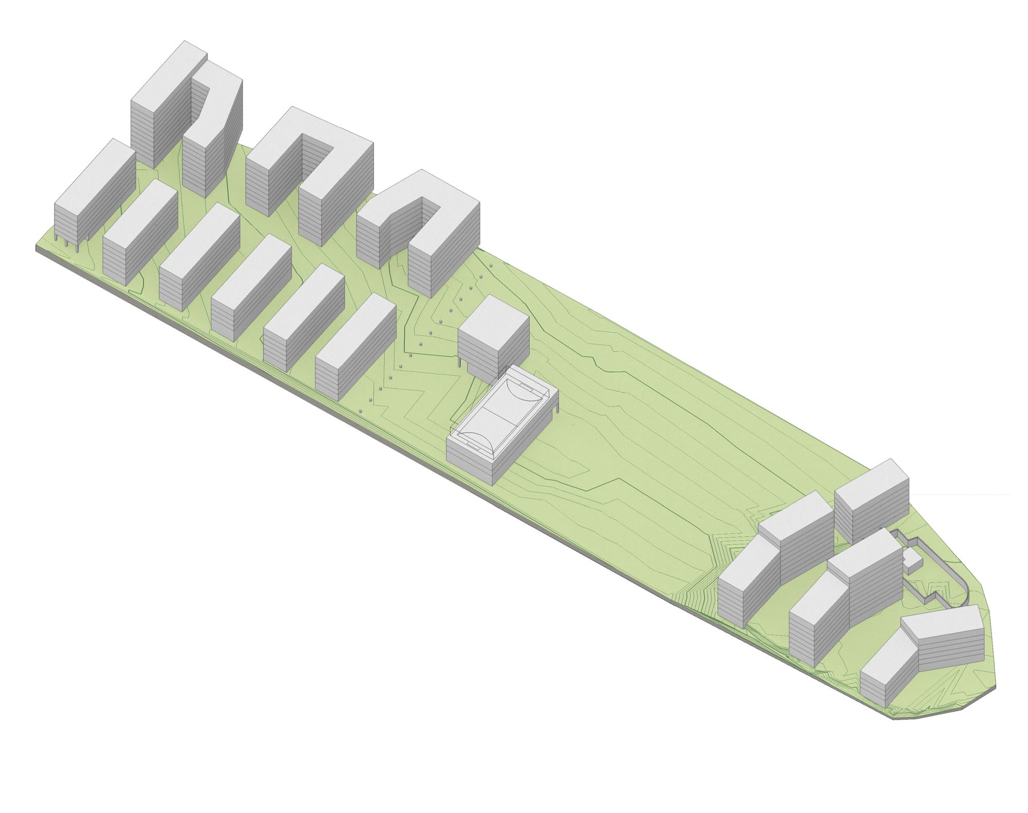
The London Legacy Development Corporation (LLDC), London Borough of Newham (LBN) and St William commissioned a multidisciplinary Design Team to develop an Urban Design and Landscape Framework for the Rick Roberts Way sites.

The Design Team comprising Henley Halebrown, 5th Studio, JCLA, Max Fordham and Price & Myers cover the fields of Architecture, Urban design, Public realm and landscape, Sustainability, Energy & Utilities and Civil & Transport Engineering.

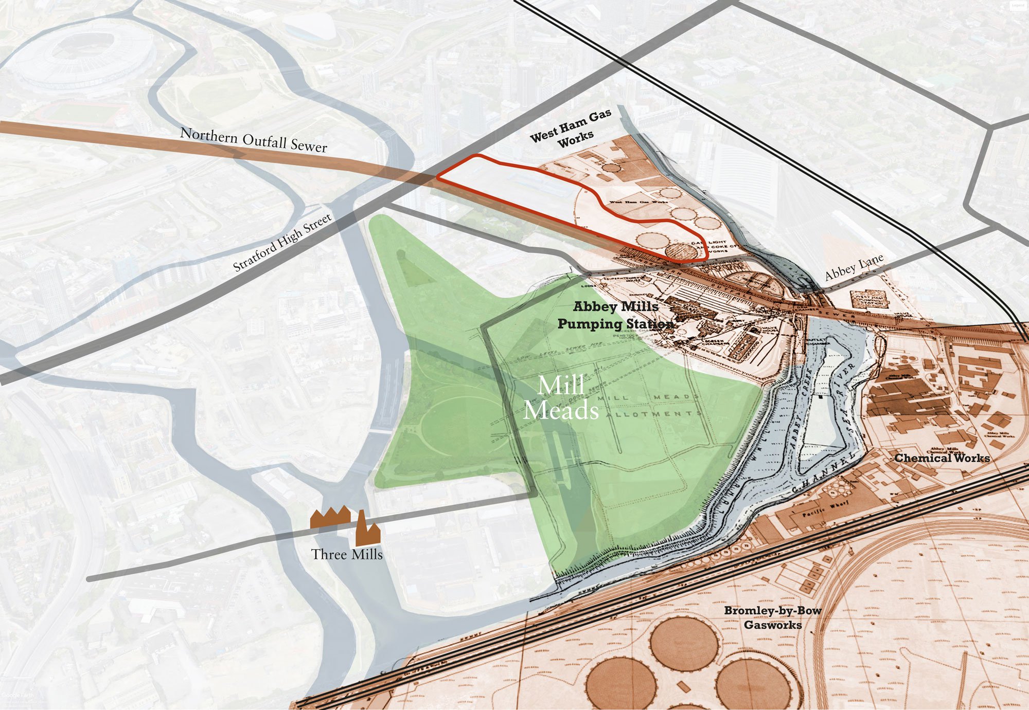
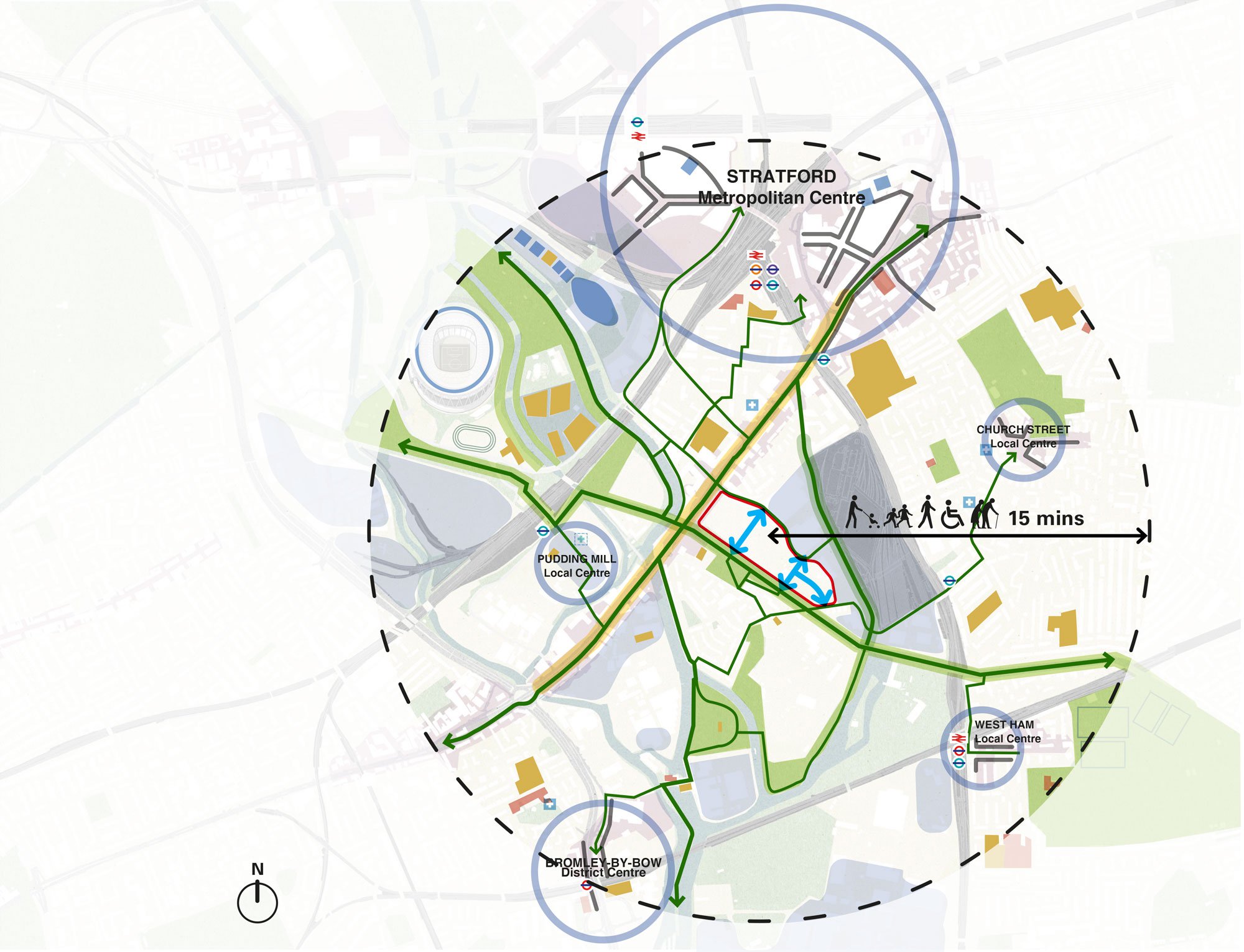
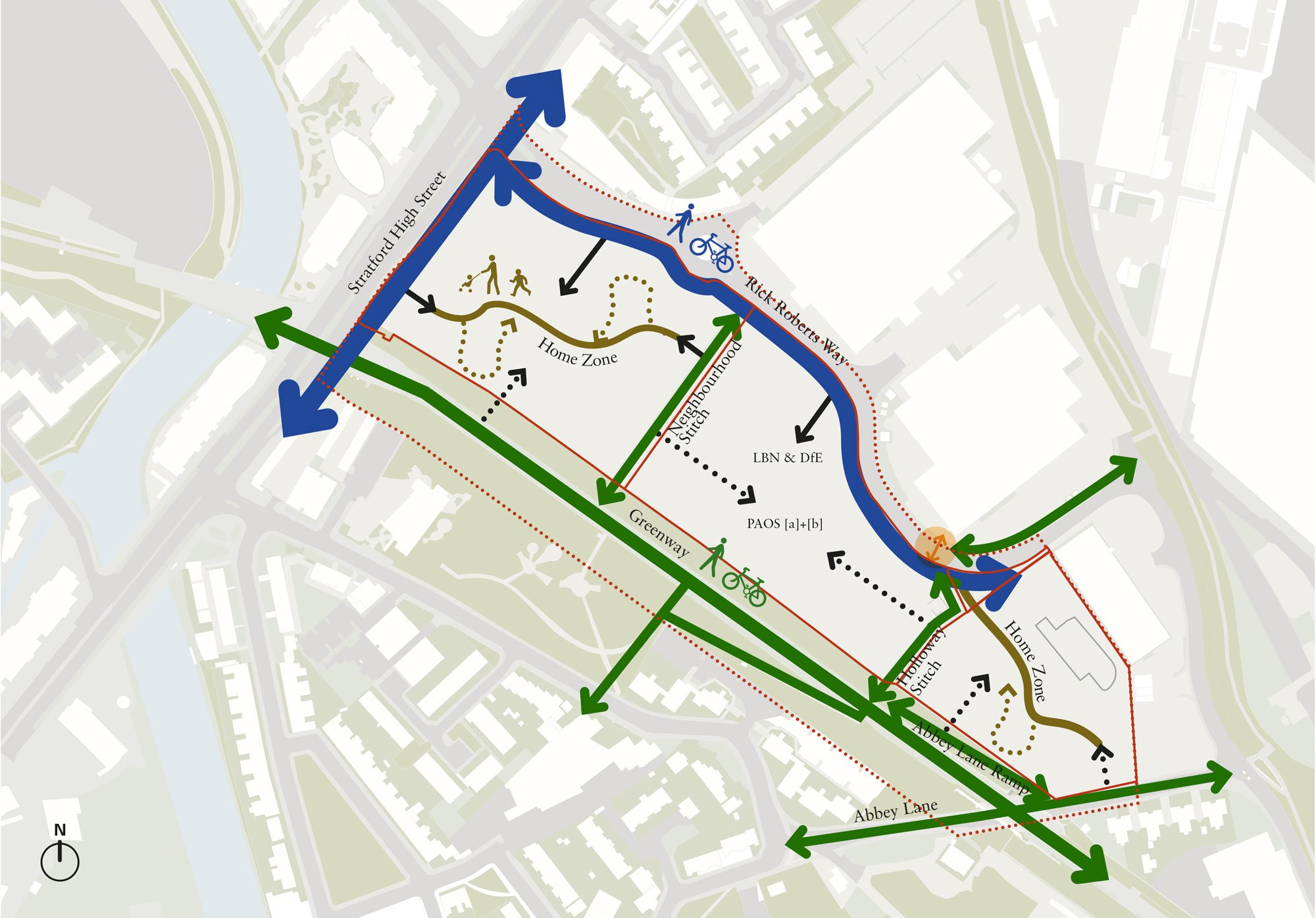
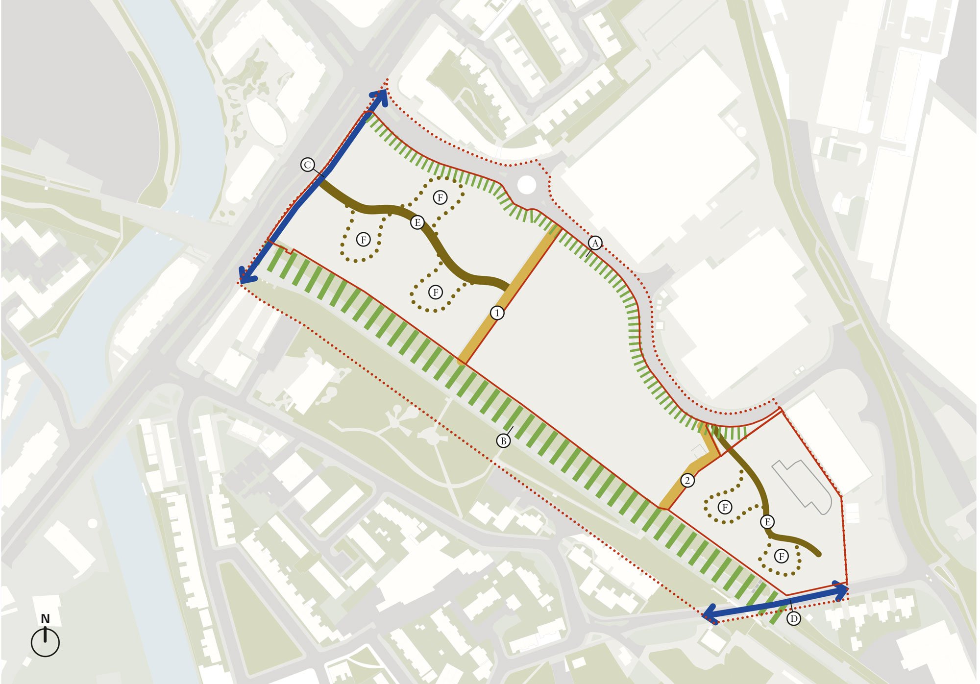
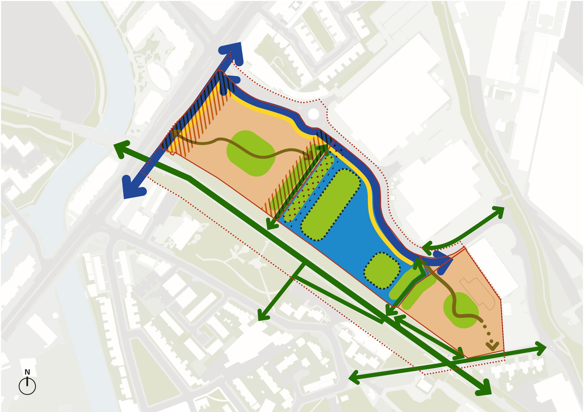
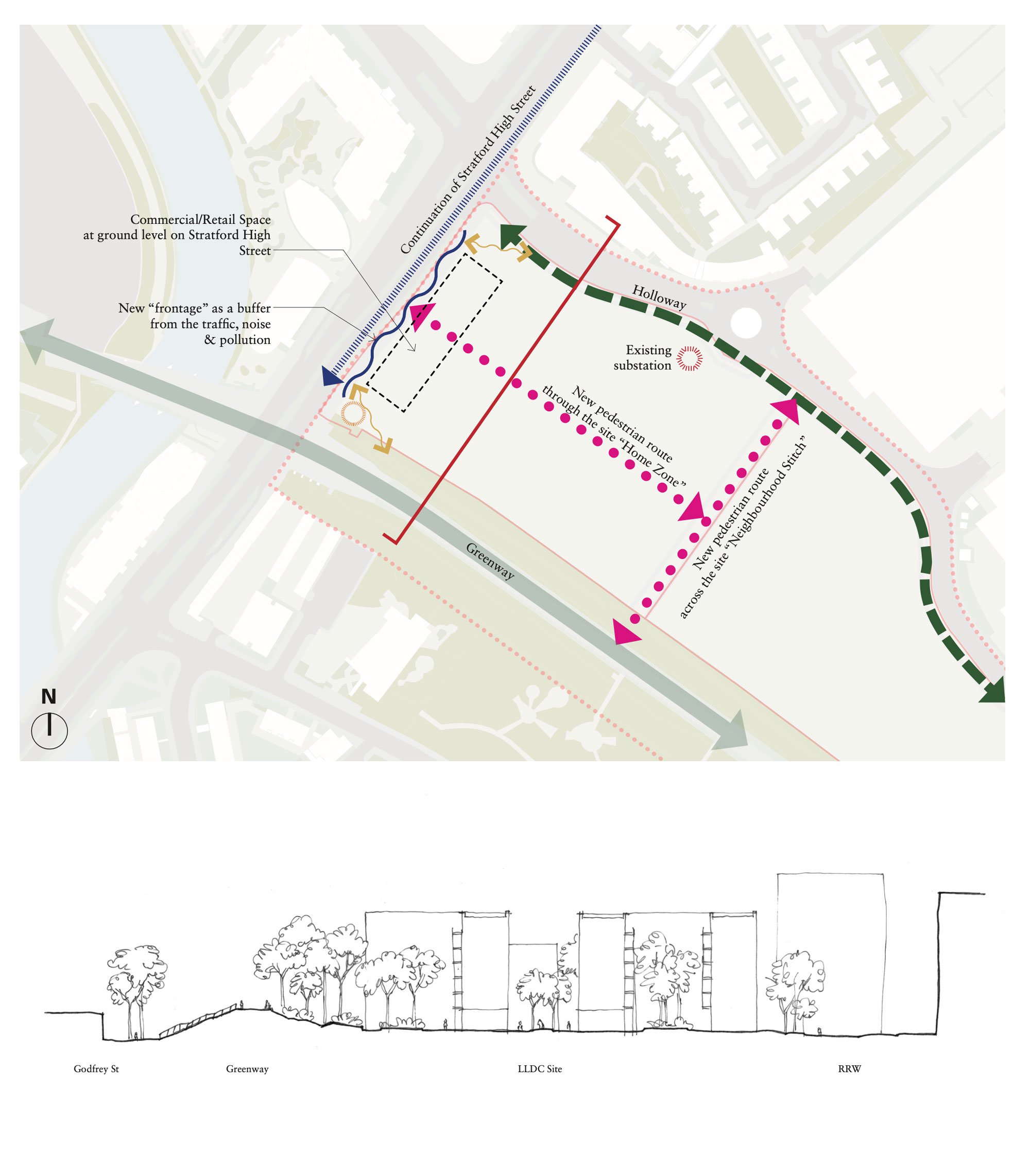
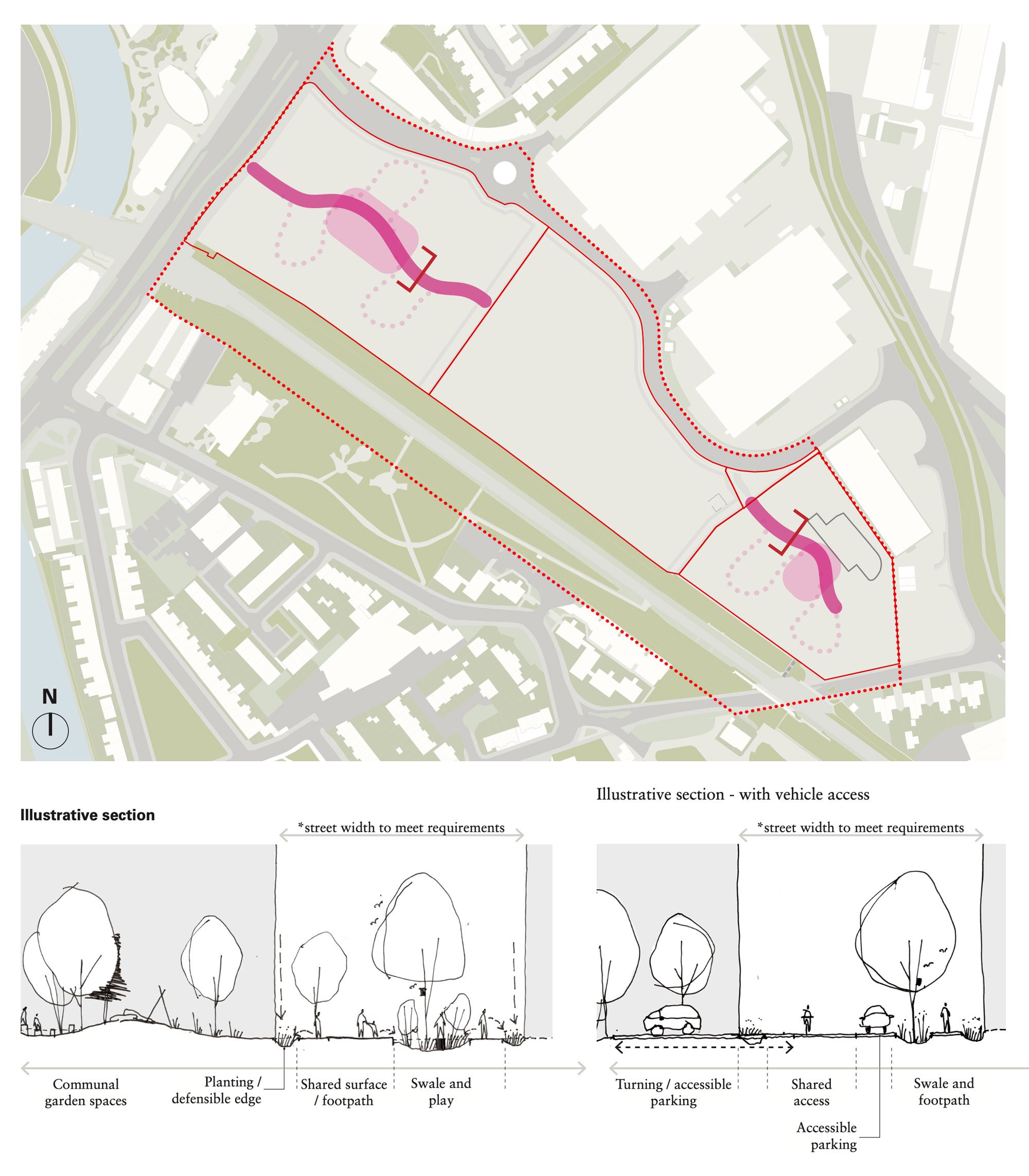
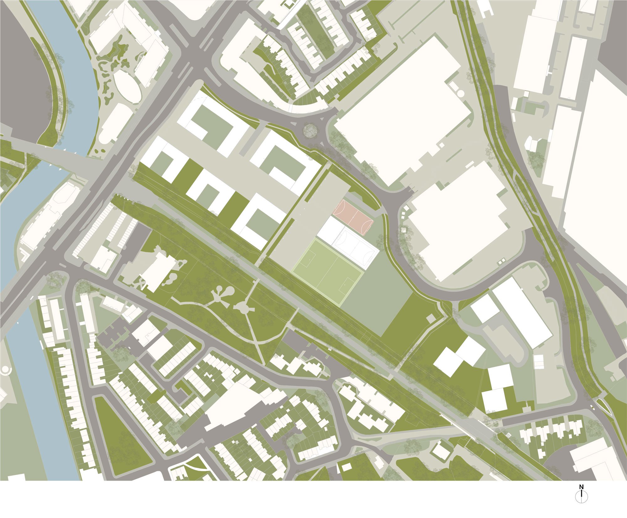
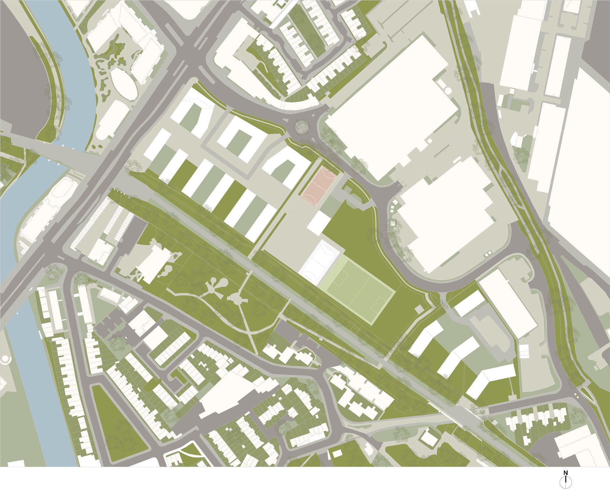
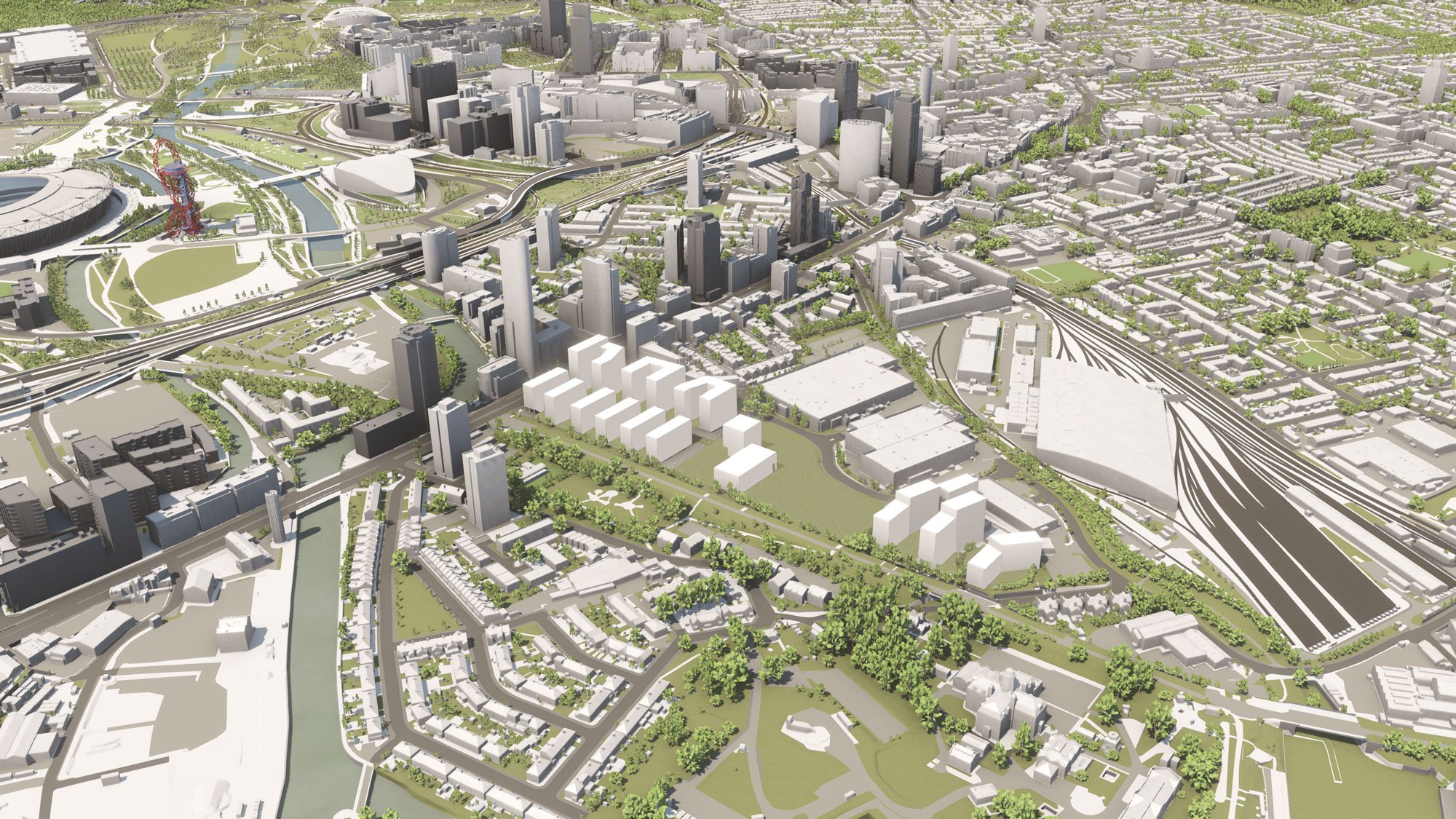
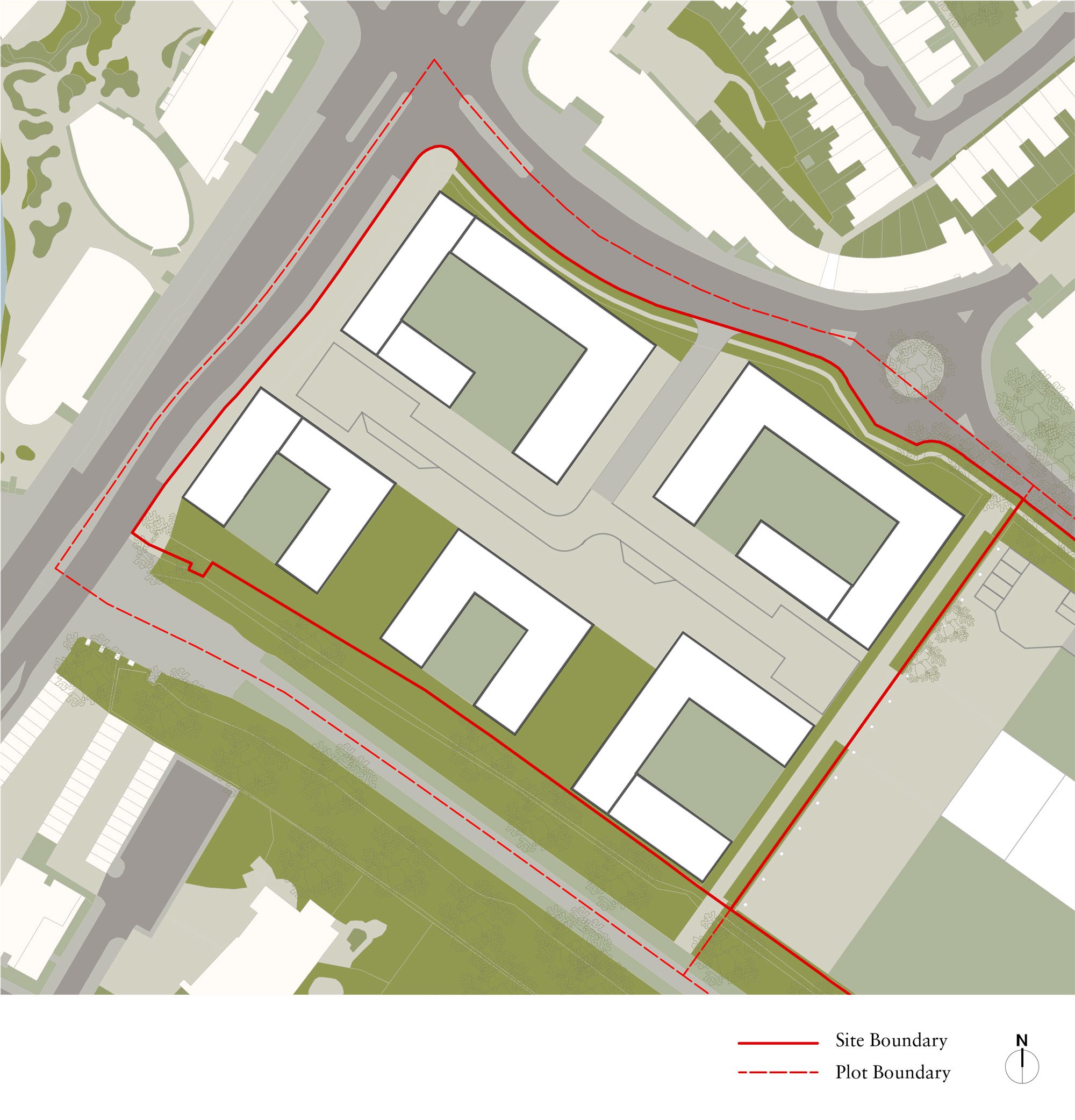
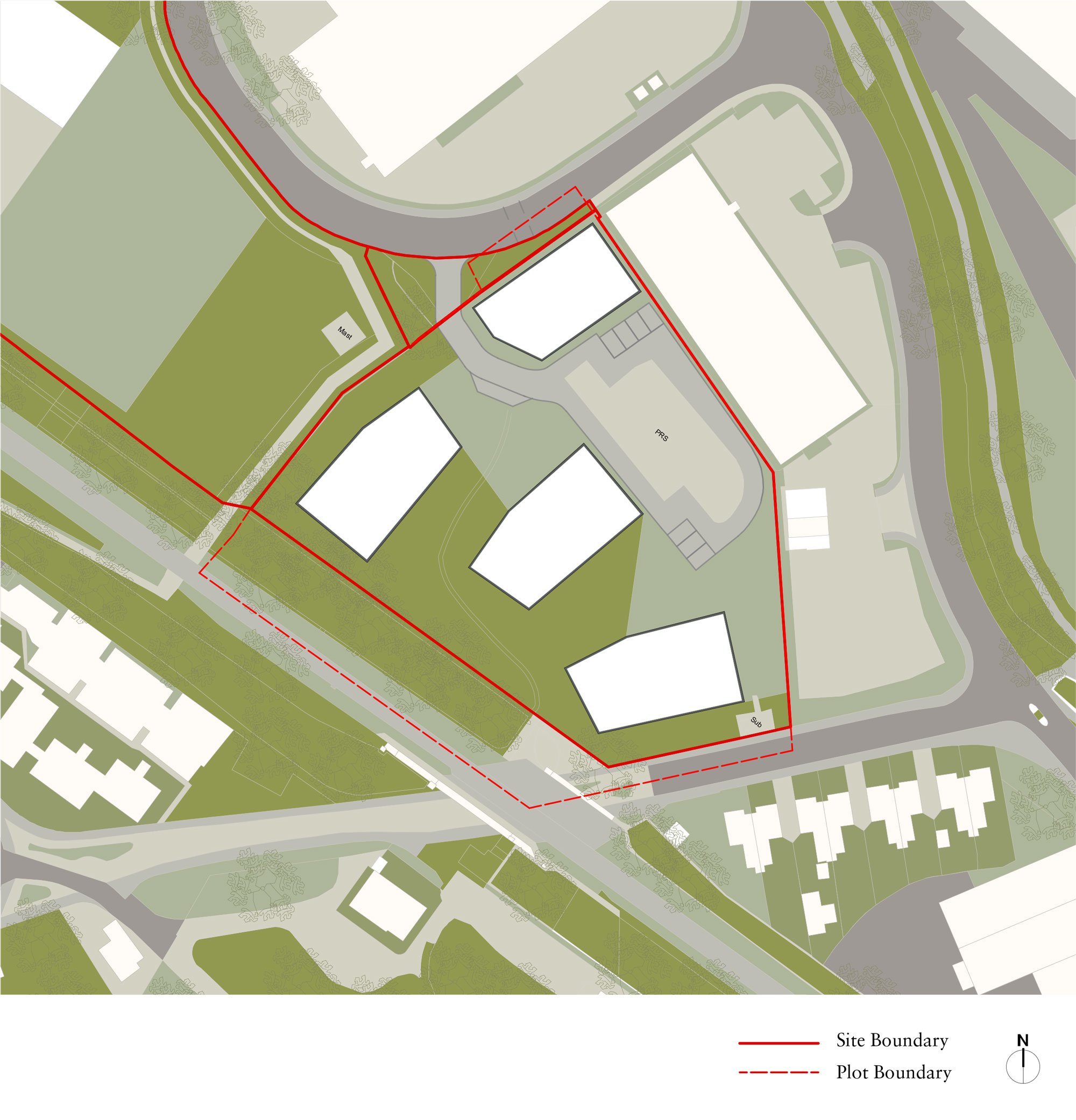
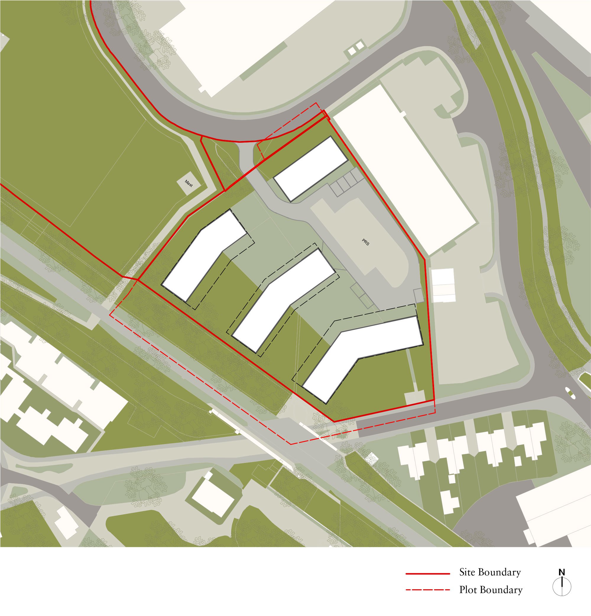
The sites comprise three parcels of land across a 4.3ha linear site, owned by LLDC, LBN and the National Grid. Together the site aims to deliver a target of 750 homes, a secondary school with a sixth form, and 1.2ha of open space.

Image 1

  • 3000_9_2011_RRW_2-1_Historic-Context.jpg
    Collage of the historic context (circa. 1800-1900)
  • 3000_9_2011_RRW_2-1-1_RRW-Channelsea-1903.jpg
    The Channelsea Creek and Gas Works
  • 3000_9_2011_RRW_4-4_15-min-City.jpg
    The aspiration is to create a ‘15-minute city’ by providing residents of Rick Roberts Way with access to amenities and employment
  • 9_2011_RRW_4-5_Route-Hierarchy
    Plan of guiding aspirations for route hierarchy (not to scale)
  • 9_2011_RRW_4-6_Urban-Landscape-Structure
    Plan of guiding aspirations for urban and landscape structure (not to scale)
  • 9_2011_RRW_4-15_Summary
    Plan summarising the guiding aspirations (not to scale)
  • 3000_9_2011_RRW_5-8_RRW.jpg
    LLDC Mixed-use Residential Site and cross section from Greenway through to RRW showing courts and gardens
  • 3000_9_2011_RRW_5-11_RRW.jpg
    Neighbourhood Spaces – Communal Routes
  • 3000_9_2011_RRW_p23_Sht-6-Massing-A.jpg
    Illustrative site plan example option
  • 3000_9_2011_RRW_p24_Option-A-Render.jpg
    Illustrative massing study example option
  • 3000_9_2011_RRW_p27_Sht-6-Massing-C.jpg
    Illustrative 3D massing model in context example option
  • 3000_9_2011_RRW_p28_Option-C-Render.jpg
    Illustrative site plan example option
  • 3000_9_2011_RRW_Sht-6-Massing-A_UNITS.jpg
    Illustrative massing study example option
  • 3000_9_2011_RRW_Sht-9-Massing-C_UNITS.jpg
    Illustrative 3D massing model in context example option
  • 3000_9_2011_RRW_JCLA_IE_SCHOOL_A_210811.jpg
    Open-sided courtyard blocks are orientated towards the Greenway. Each courtyard benefits from long south-west views and aspect towards the Greenway
  • 3000_9_2011_RRW_JCLA_IE_SCHOOL_C_210811.jpg
    A finer grained approach. The terraced blocks are joined along RRW to maintain a level of solidity and protection from traffic. Communal gardens and green streets benefit from long south-west views
  • 3000_9_2011_RRW_Sht-6-Massing-B_STW_UNITS.jpg
    Illustrative school site plan example option. The taller school volume is located here to mark the entrance to the school and to terminate the view from the residential Home Zone.
  • 3000_9_2011_RRW_Sht-6-Massing-C_STW_UNITS.jpg
    Illustrative school site plan example option. A diagonal composition of school building volumes. This layout defines its external spaces as courts and precincts and shows the
  • 3000_9_2011_RRW_Option-A-Axo.jpg
    Illustrative site plan example option. A series of faceted free-standing volumes sitting within a landscape setting. Height is concentrated away from Abbey Lane and towards the middle of the site
  • 3000_9_2011_RRW_Massing_Option-C-Axo.jpg
    Illustrative site plan example option. Order and orientation to the Greenway. These off-set, contoured, blocks permit long views through the site, maintain good overlooking distances, passive surveillance, whilst capturing long undulating communal landscapes between them

Technical

  • Area: 4.3ham2
  • Client: London Legacy Development Corporation (LLDC), London Borough of Newham (LBN), St William
  • Urban Design: 5th Studio
  • Landscape Architect: JCLA
  • Services Engineer: Max Fordham
  • Engineering consultant: Price & Myers
Top ↑